
The Empakai to Natron walk has been on my to-do list for many years: one of those things that is on your doorstep that you just never get out and do. When, Ake Lindstrom from Summits-Africa, Frank Castro from Adventure International, and Gian Schachenmann, Tanzania’s ultimate drone photographer, decided to do a trip to make a promotional film, I jumped at the chance to join as a recce as it is known in the safari world- an abbreviation of the word reconnoitre. I was amused being on the receiving end of an itinerary and getting the list of what to pack, and like most guests of mine, I disregarded the list and packed what I wanted to anyway, except that I did succumb to the advice of my wife to actually wear hiking boots.
Not only was the hike through dramatic views, but it was also geologically fascinating. The hike started at Empakai Crater, a beautiful caldera that is about 7 km in diameter with a typical alkaline lake thats waters reflect the dark forested walls that rise up 980m from the crater floor, and whose shoreline is encrusted with the snow-white residue of the alkaline salts. The first campsite was on the rim of the crater in the montane forest. We woke in cloud, surrounded by beautiful Hygenias thats flowers hung like giant bunches of grapes and Giant St. John Wort bushes, a habitat I associated more with mountain gorillas.
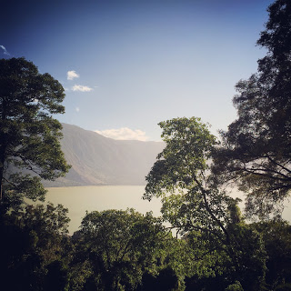
Empakai crater

Crotalaria species on the descent path.
Descending from the 2500m altitude, we left the forest and entered the drier grasslands. It was the perfect trip to discuss the effect that water has on life. The fertile soils, refreshed with new ash from Oldonyo Lengai every couple of decades or so provide abundant grazing for the cattle, sheep and goats that the Maasai tend. The easily eroded light soil forms deep gullies running from the highlands and incredible canyons lower down. These porous soils drain water efficiently, therefore trees cannot establish themselves, yet as we descended we found ourselves in one of the canyons, surrounded by a beautiful yellow-fever acacia forest. It is initially a surprise as these trees dominate swamps, and this was no swamp. But it indicated water, and though we never saw it, there must be a high-enough moisture content in the soil for these trees to grow. This was the setting for our mid-way camp and that afternoon we climbed a steep knoll to look out across the view.
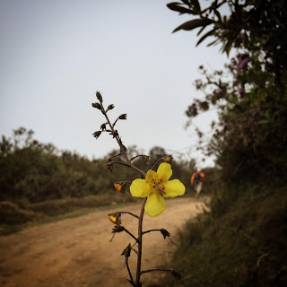
Roadside flowers
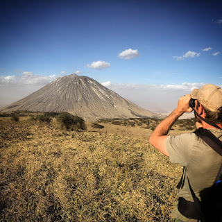
At this point in the walk, the rift valley wall, an uplifted escarpment became more and more imposing, while Oldonyo Lengai, the active volcano, stood out against the sky. In the distance, other volcanoes rose out of the dust as if hanging in the sky: Kitumbeine to the east, Shompole and Oldonyo Sambu to the north. The Masonik volcanoes appeared tiny in the Angata Salei plains and if you squinted you could see the Gol mountains to the west, where in 2007 & 2008, Gian and I had watched Oldonyo Lengai send pyroclastic clouds 30 000 ft into the sky.
On the last day of the trek, we followed a well worn donkey trail used by Maasai who move between the weekly markets bringing corn from the highlands and taking back bricks of natron (Sodium bicarbonate) to mix with tobacco for snuff and to soften beans. We left the fever tree forest and as whatever moisture there was in the soil also disappeared, we found ourselves on a knife-edge ridge, devoid of vegetation except for a thick tussock like grass. One could imagine that this trail we followed had been used for transit for millennia between the fresh waters at Ngaresero on the shores of Lake Natron, and the crater highlands. After lunch in the shade of a ravine, we trekked the last couple of miles to the vehicles that were waiting. It was a quick drive to camp and we quickly settled into the natural pools with ice-cold beers, the sweat and dust washing off. Fish nibbled at our toes and we discussed the activities for the next day.
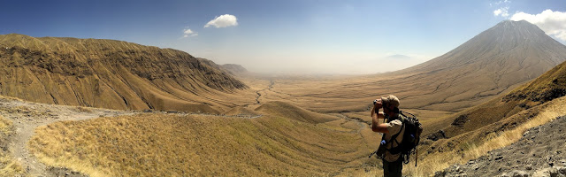
The donkey path with the rift valley escarpment on the left and Oldonyo Lengai on the right.
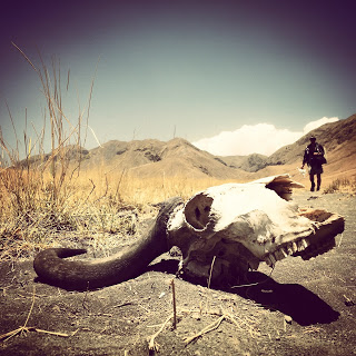
Wildebeest skull at the bottom of the valley.
One of the striking things about this area is how harsh and hostile it is. Windswept and barren mudflows, dry cracked pans, brittle volcanic outcrops, the caustic bicarbonate lake, and stark volcano not to mention wind and sun, yet there are oases where life flourishes. The mineral rich springs along the edges of the lake grow algae that feeds and provides shelter for abundant specialized fish and lesser flamingos. Invisible moisture supports Acacia tortilis woodlands that feed giraffe, and sheltered spots provide enough grazing for zebra, wildebeest, and Grant’s gazelle. One of the most beautiful oases is the clear water that flows out of the rift wall.
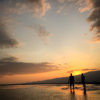
Dawn on the lake shore.

Lake Natron Panorama
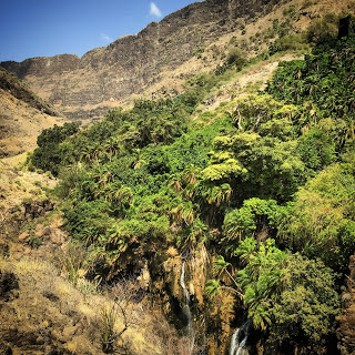
The incredibly lush forest in an otherwise desert scrub environment.
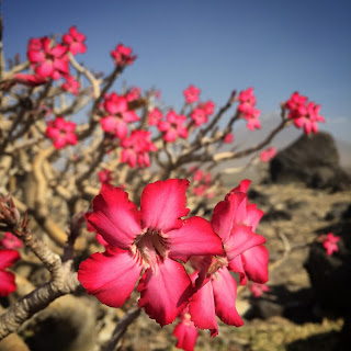
The incredible blossoms of the Desert Rose.
Having played in the waterfalls and clear waters toward the mouth of the gorge, I had never been to the source of the river and a small group of us decided to make the trek. It was very different walking in flip-flops and often barefoot as we scrambled up the boulders, jumping into pools and showering in the natural waterfalls along the way. In many ways it was paradise.
